Conserving a map charting the course of the most legendary naval operation for D-Day 80
- View news filtered by: Museum Story
- View news filtered by: Second World War
- View news filtered by: Museum behind the scenes
- View news filtered by: Conservation
- View news filtered by: D-Day 80
- View news filtered by type: Press Release

In June 1944 Southwick House, just outside of Portsmouth, became the nerve centre of the largest amphibious invasion in military history. Southwick House was the headquarters for the planning of D-Day, the plan to liberate France from the grip of the Nazi war machine and to eventually end the war in Western Europe. The commanders based here included the Supreme Commander of the Allied Expeditionary Forces, Dwight D. Eisenhower, Commander in Chief of the Allied Naval Forces for Operation Neptune, Admiral Sir Bertram Ramsay, and Commander-in-Chief of Allied Ground Forces General Bernard Montgomery.
The map entered the collection of the National Museum of the Royal Navy in 2017, and now being 80 years old the D-Day map at Southwick House required conservation works. Freelance conservator Emily Kelmendi was brought in to undertake works to ensure the map is around for the next 80 years, and kindly spoke to us about the process.
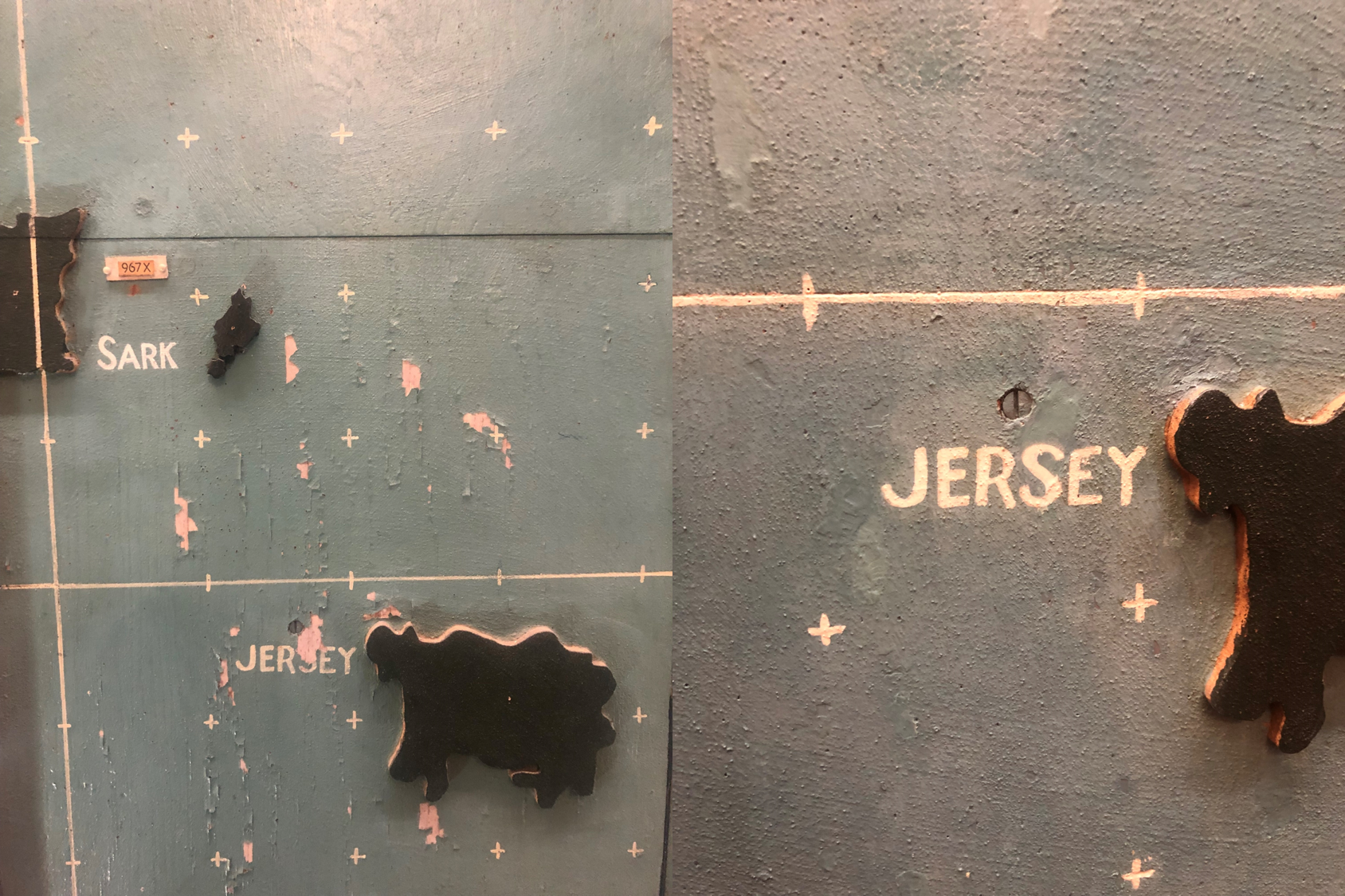
Flaking paint, caused by years of moisture damage, was the most visible issue with the map. This meant there was a real risk of losing the original paint. To combat this, a light adhesive was used to stick down peeling paint where possible. The properties of this adhesive means it can be re-worked for any future conservation efforts.
Other work included retouching areas to ensure the map retained its look and didn’t lose the readability of some of the wording, as well as cleaning each of the individual pins and ships listed on the map. The work around this can be seen below, as the peeling paint is stuck down, and the word ‘Jersey’ made readable again.
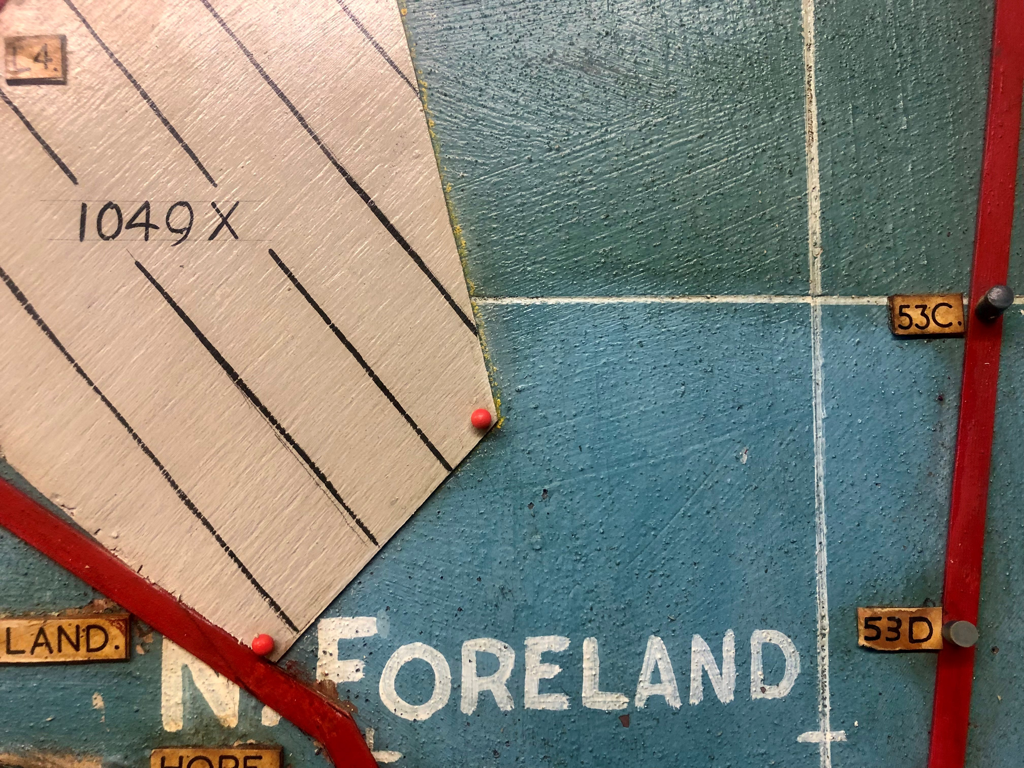
The second main issue is more surprising, a layer of nicotine on the map had caused discolouration, most noticeably turning the blue sea of the map green. This nicotine layer had accumulated over time and would not have been present when the map was originally used for D-Day, so it was necessary to remove. This issue meant that every centimetre of the map, over 28 square metres, needed to be cleaned by hand, sometimes using tiny cotton buds. However, once complete, the difference was immediately noticeable:
Emily’s work usually concerns paintings, including landscapes. Surprisingly, the work on the D-Day map required very similar materials and methods for its conservation, but on a much larger scale, being “like cleaning 50 small paintings”. Emily felt honoured to work on something of this scale and historical importance, as her work usually concerned more decorative works. The before and after images of the D-Day map are staggering, and it’s fantastic to ensure the map is available for the next generation of people to learn all about the planning that went into this legendary event.
The map is one of the objects submitted by the National Museum of the Royal Navy to the D-Day Story’s ‘D-Day in 80 Objects’ project. You can learn more about the project on the D-Day Story’s website, and about the objects submitted by the museum in a blog post on the website.
There’s also a separate blog on the website discussing D-Day generally, and especially the role of the Royal Navy. While the D-Day map at Southwick House is not currently available for the general public to view, a brand new digital version, tracking the progress of the D-Day landings is available now on the NMRN website.